Community member Barf contacted me recently to offer his work on a custom DEM for Auckland, Wellington and Queenstown. This is a heap of work that improves the 3d model of the ground.
I will run this DEM through Ortho4XP, so people can grab the results if they want a much better mesh.
Currently the mesh that I’m using is pretty much the same as the default X-Plane which is nice for the frame rate, but can be a little jagged when you are close to the ground. With improved meshes you also get improvements on the way shadows interact with the ground.
Here’s what I mean – look at the hill to Parnell, and the swimming pool isn’t even flat!

I patched the pool to be flat in R4.
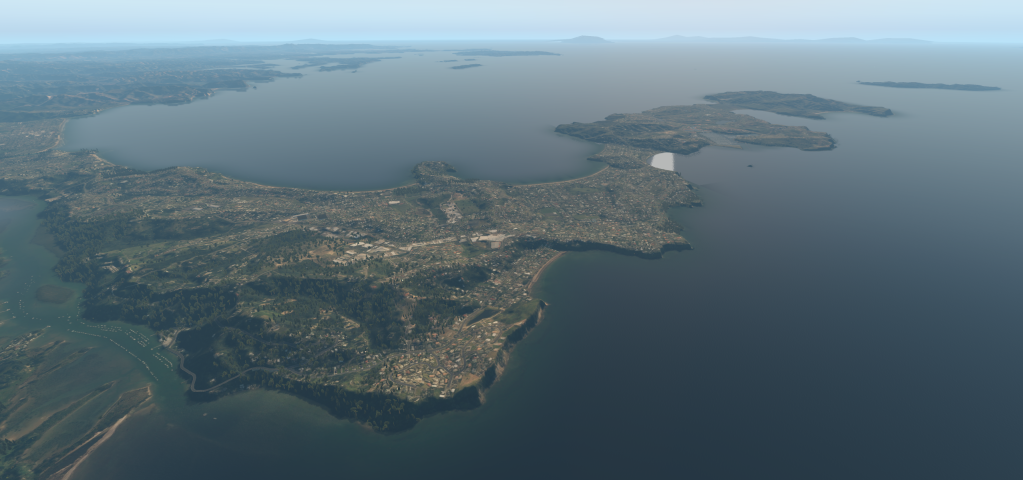
The four tiles for Auckland cover from the Kaipara Harbour down to Hamilton, and from the Waitakere Ranges over to the Coromandel.
Here is a look at the result:
Parnell now looks like a pool at sea level with cliffs and houses above. No patching required for the pool.

You can see a side by side comparison of before and after within this image

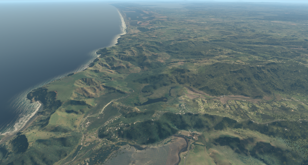
All sorts of cliff edges become visible, and it brings out the ridges of the Waitakere Ranges. Here’s another look north towards Muriwai.
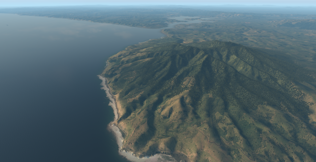
Moving south, here’s a look at Manukau Heads:


If we continue south, we can see some nice detail on the hills around Raglan:
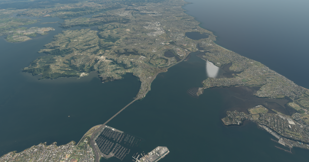
Heading back up to Auckland Intl, the harbour and estuaries start to have shores and banks defined.
The same is true for the shoreline of the Waitemata:

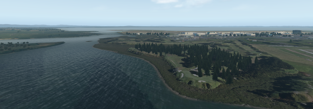
I like to fly in and out of NZRV, and it’s good to see the sloped runway nicely captured on Waiheke Island, no without a mesh patch.


Great barrier is also look ‘great’ 🙂


Who wouldn’t want to stop in at Coromandel Airstrip?

Over the other side of the Coromandel, Whitianga is also looking good:


Finally, you can see a highly defined shoreline at Whangaparoa:
I’ll do a bit more testing, before I release these new tiles. Auckland’s 4 tiles alone are coming in at about 40GB. You’ll need to copy over the default tiles that come along with Northland.
Categories: Flight Simulation
 On a layOver
  Freeware – OSM Overlay for New Zealand and the Chatham Islands
  The (Over)lay of the land
  Lyndiman’s Ortho UHD Mesh Release
Do the mesh improvements extend to Great Mercury, Cuvier and the other islands near Great Barrier? I assume this is likely, if Whitianga is covered.
– Chris
Yes, but I think the data will be derived from an 8m DEM.